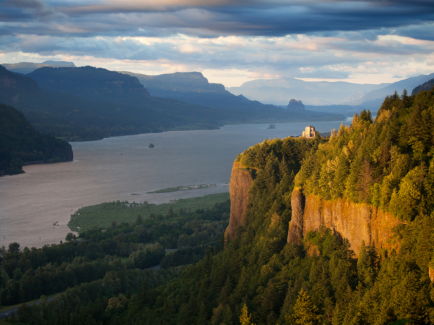
Many creationists are familiar with the breached-dam explanation for the Channeled Scablands of eastern Washington.1 During the Ice Age, the dam holding glacial Lake Missoula in western Montana burst. This sent an estimated peak flow of 740 million cubic feet per second through the Spokane Valley and down the Columbia River, draining all 540 cubic miles of water in just three days.2,3 However, few realize that the basalt lavas that were exposed by the catastrophic outflow also open a window into the great Flood.
The Columbia River cuts through the middle of the Columbia Plateau. This broad, flat region was formed by massive outpourings of lava that covered 81,000 square miles in Washington, Oregon, and Idaho. Known as a flood basalt,4 these lavas are even less viscous (i.e., flow easier) than the Hawaiian basalts. Individual lavas extend up to 470 miles.5 Similar flood basalts are found around the globe, such as the Deccan Plateau in India.
Many basalt lavas have particular cooling textures, such as columnar jointing that makes vertical hexagon-shaped columns. Some textures can indicate whether the lava erupted underwater. Lavas can flow great distances underwater as long as a thin film of insulating steam bubbles protects the flow from cooling.4
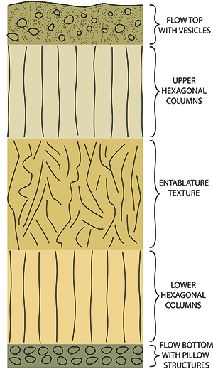
The Columbia Plateau lavas also have flat tops and bottoms, with no indication of erosion or vast time between the flows.4 The tops of many flows are filled with gas holes and are often glassy. Some flows are pillowed, especially on the edges. Pillow structures (rounded spherical shapes) only form underwater, indicating that water was covering the land.
Another significant texture called entablature verifies that many of the lava flows were cooled by active flooding. Entablature has an irregular curvi-columnar or wavy-distorted fracture pattern (Figure 1).4 In the Columbia Plateau, entablature makes up the bulk of most lavas.4 It forms when water floods across a fresh lava surface that has begun to cool.6 Water seeps into the cracks and rapidly quenches the remainder of the flow, making entablature’s distinctive chaotic texture.
Because entablature requires flooding, conventional geologists argue that the lavas flowed across dry land and dammed local rivers, causing water to overflow on top of the lavas.4 The problem is that not many lava flows would have encountered a river or water source to flood the lava. Entablature is too common in the Columbia Plateau for this scenario.
Flood geologists have a better explanation. The Columbia Plateau lavas erupted near the end of the Flood’s receding phase (Miocene).7 Floodwater likely hadn’t fully drained from the region, and rapid creation of new ocean crust was ongoing, resulting in large earthquakes and tsunamis. These massive waves were still crashing across Oregon and Washington and over the tops of the fresh lava flows, quenching the molten centers and forming entablature.
The global Flood and the subsequent Ice Age provide the best explanation for the geology of the Columbia Plateau. The receding phase of the Flood provided the water necessary to make the entablature and rapidly cool the lavas. And the outflow from a dammed Ice Age lake provided the erosional forces needed to create the modern landscape and cut canyons through the lavas. When conventional geology has problems, Genesis has solutions.
References
- Oard, M. J. 2004. The Missoula Flood Controversy and the Genesis Flood. Chino Valley, AZ: Creation Research Society Books; Morris, J. 2011. The Channeled Scablands. Acts & Facts. 40 (10): 15.
- Baker, V. R. 1973. Paleohydrology and Sedimentology of Lake Missoula Flooding in Eastern Washington. Geological Society of America Special Paper 144. Boulder, CO: Geological Society of America.
- O’Conner, J. E. and V. R. Baker. 1992. Magnitudes and implications of peak discharges from glacial Lake Missoula. Geological Society of America Bulletin. 104 (3): 267-279.
- Reidel, S. P. et al. 2013. The Columbia River flood basalt province: stratigraphy, areal extent, volume, and physical volcanology. The Columbia River Flood Basalt Province: Geological Society of America Special Paper 497. S. P. Reidel et al, eds. Denver, CO: Geological Society of America, 1-43.
- Reidel, S. P. et al. 1989. The Grand Ronde Basalt, Columbia River Basalt Group: Stratigraphic descriptions and correlations in Washington, Oregon, and Idaho. Volcanism and Tectonism in the Columbia River Flood-Basalt Province: Geological Society of America Special Paper 239. S. P. Reidel and P. R. Hooper, eds. Denver, CO: Geological Society of America, 21-52.
- The hexagonal fractures produce a uniform vertical fracture texture called columnar jointing. This is what is observed at Devil’s Tower in Wyoming.
- Clarey, T. 2020. Carved in Stone: Geological Evidence of the Worldwide Flood. Dallas, TX: Institute for Creation Research, 312-353.
* Dr. Clarey is Research Scientist at the Institute for Creation Research and earned his Ph.D. in geology from Western Michigan University.